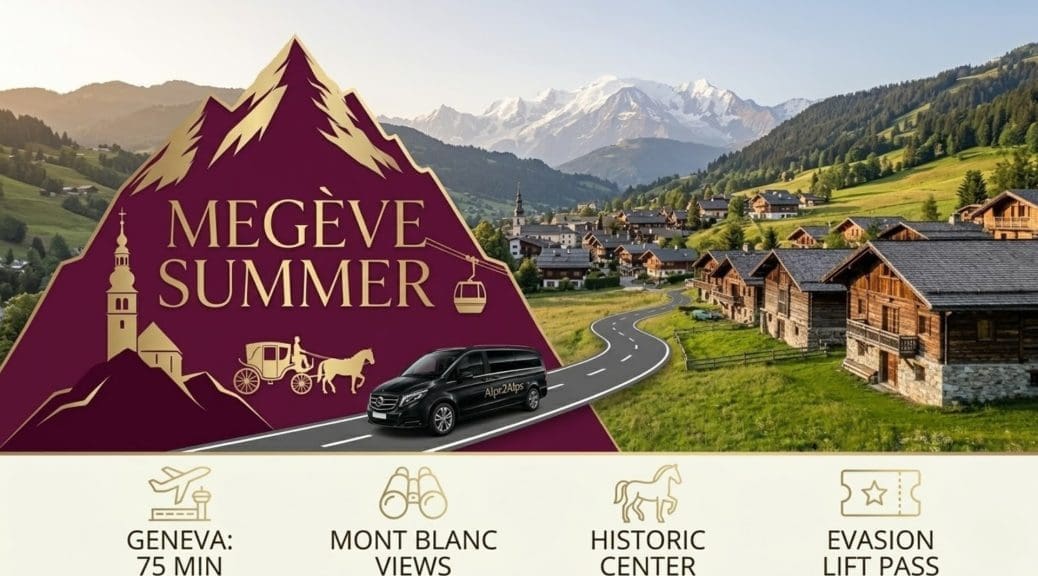
Building Summer Sightseeing Travel Itineraries for Megève
TL;DR: Building Summer Sightseeing Travel Itineraries for Megève
Constructing a high-yield summer sightseeing itinerary for Megève demands rigid logistical control over transport and lift network access. The 2026 operational landscape requires travellers to bypass public transit inefficiencies by securing direct Alps2Alps transfers from Geneva or Chambery airports. This point-to-point delivery model eliminates the severe luggage handling friction associated with SNCF rail connections to Sallanches, depositing visitors directly at the perimeter of Megève’s heavily restricted pedestrian zones.
Executing the itinerary relies on integrating the municipal Meg-bus system with the high-altitude mechanical lift infrastructure. Accessing premier Mont Blanc viewing platforms or executing historical tours of the Rothschild-era architecture dictates strict schedule adherence. Maximising the operational window requires pre-purchasing pedestrian lift passes and synchronising daily ascents with morning weather windows to avoid the predictable afternoon thermal convection that obscures high-alpine visibility.
Architectural Heritage: Navigating the Historic Centre
Operating Within the Pedestrianised Zone
The historic centre of Megève operates under strict vehicular prohibition during the summer season. Hydraulic bollards and camera surveillance networks enforce a permanent Zone Piétonne across the primary cobbled streets radiating from the Place de l’Eglise. Navigating this sector requires a strictly pedestrian approach. Visitors attempting to breach these restrictions with personal rental vehicles face immediate automated fines and physical barricades.
Constructing a central sightseeing itinerary dictates base camp selection within immediate walking distance of the central square. Securing accommodation on the periphery forces reliance on the municipal shuttle network for basic dining and historical tours. Positioning within the pedestrian perimeter allows immediate, frictionless access to the primary architectural assets, eliminating micro-transit delays from the daily schedule.
Within this zone, traditional horse-drawn carriages (calèches) present the only authorised vehicular movement. While marketed as a heritage experience, they function as a practical mobility asset for individuals with restricted physical capacity navigating the steep inclines of the central cobbled streets. Integrating this transport into an itinerary requires pre-booking during the peak July and August windows, as ad-hoc availability drops to zero by mid-morning.
Executing Historical and Cultural Traverses
Megève’s architectural baseline differs fundamentally from purpose-built French alpine resorts. The infrastructure was heavily engineered in the 1920s by the Rothschild family to directly rival St. Moritz. A targeted historical itinerary isolates specific assets, beginning with the Église Saint-Jean-Baptiste. This central structure dictates the surrounding urban flow. Executing a comprehensive review of its interior and the adjacent priority heritage buildings requires allocating a specific 90-minute morning block before peak tourist density is reached.
The Chemin du Calvaire represents a mandatory cultural traverse. This historical path, featuring 14 distinct chapels charting the Passion of Christ, ascends from the village centre up the slopes of Mont d’Arbois. Navigating this route demands appropriate footwear and physical exertion, transitioning the itinerary from urban sightseeing to light alpine hiking. Planners must schedule this ascent during the early morning to bypass severe afternoon thermal exposure, as the trail provides minimal canopy cover.
Accessing local heritage museums, including the Musée de Megève, requires strict adherence to municipal operating hours. In 2026, these facilities operate on staggered summer schedules, frequently closing for extended mid-day periods. Attempting to execute cultural visits between 12:00 and 15:00 guarantees failure. Itineraries must front-load museum access into the morning blocks, reserving the afternoon for high-altitude lift deployments or shaded valley walks.
Aviation Ingress: Geneva and Chambery Airport Transfers
Geneva Airport Routing and Execution
Geneva Airport (GVA) functions as the primary aviation node for Megève summer operations. The geographical proximity dictates a rapid 75-minute ground transit phase. The route follows the Autoroute Blanche (A40) towards Sallanches before initiating the steep D1212 ascent into the resort. This high-speed corridor isolates travellers from the multi-hour delays typical of deeper alpine destinations.
Securing a Geneva to Megève transfer via Alps2Alps remains the absolute baseline for logistical efficiency. Relying on the Swiss or French rail networks from the terminal introduces catastrophic itinerary friction. Public rail vectors require transit to Geneva Cornavin, followed by a connection to Sallanches, terminating with a local bus ascent. This multi-modal sequence doubles the transit time and forces manual hauling of summer baggage across fragmented platforms.
The professional transfer protocol eliminates terminal loitering. Drivers intercept passengers directly at the Geneva arrivals gate, executing an immediate departure. The vehicle delivers visitors straight to the perimeter of the pedestrian zone. For properties located within the restricted centre, the transfer terminates at the closest authorised drop-off point, where hotel porter services or short-range electric shuttles execute final luggage integration.
Chambery Airport Alternative Vector
Chambery Airport (CMF) provides a highly specific alternative ingress vector, particularly for travellers utilising regional or chartered flight networks. While operating on a smaller scale than Geneva, Chambery bypasses the massive international passenger volumes and severe border control delays typical of major summer hubs. The transit route from CMF to Megève measures approximately 90 kilometres, weaving through the Arly Gorge via Albertville.
Executing a Chambery to Megève transfer requires navigating distinct topographical challenges. The route through the Gorges de l’Arly is susceptible to summer road works and occasional rockfall closures. Professional drivers utilising real-time GPS telemetry mitigate these variables, rerouting via the Col des Saisies when the primary valley floor artery fails. Relying on standard municipal taxis for this route guarantees exposure to unmetered detours and inflated tariffs.
Deploying an Alps2Alps vehicle from Chambery ensures the allocation of a long-wheelbase asset capable of internalising oversized summer gear, such as premium golf clubs or specialised trekking equipment. The transit time averages 90 to 105 minutes. This point-to-point delivery mechanism preserves the traveller’s baseline energy levels, allowing immediate deployment onto the sightseeing itinerary upon resort arrival rather than mandating a dedicated post-transit recovery day.
Transport Execution: Alps2Alps Megève Routing
Navigating the Autoroute Blanche and D1212 Corridor
Routing from Geneva to Megève relies primarily on the Autoroute Blanche (A40). This high-speed vector channels traffic efficiently towards Sallanches. During the peak summer window of July and August 2026, the A40 experiences severe capacity strain from international tourism and freight detours. Executing this segment requires precise timing to avoid peak weekend gridlock near the Mont Blanc tunnel approach.
The critical phase of the transit occurs upon exiting the A40 at Sallanches. The route shifts to the D1212, initiating the steep, winding ascent into the Megève valley. This two-lane arterial road constitutes a major structural bottleneck. Heavy agricultural vehicles and massive influxes of touring cyclists routinely stall upward momentum. Overcoming this friction point dictates reliance on professional transit operators equipped with real-time GPS telemetry to exploit brief passing windows and maintain schedule integrity.
Securing an Alps2Alps transfer asset guarantees the deployment of drivers with specific topographical intelligence. When the primary D1212 corridor fails, these operators execute immediate reroutes via secondary access roads, bypassing stationary traffic. Relying on standard public transit or algorithm-dependent rideshare applications on this ascent mathematically guarantees severe delays, fracturing the tightly scheduled sightseeing itinerary before it begins.
High-Capacity Fleet Architecture and Point-to-Point Execution
Executing a Geneva to Megève transfer or a Chambery to Megève transfer for summer sightseeing requires dedicated fleet architecture. Summer manifests routinely include oversized, rigid luggage such as premium golf travel bags, extensive climbing hardware, and rigid mountain bike boxes. Standard municipal taxis completely lack the internal cubic volume to secure these loads without breaching passenger seating zones or resorting to unsecured external roof racks.
Alps2Alps deploys long-wheelbase, high-capacity passenger vans engineered specifically for alpine logistics. This configuration ensures all oversized summer equipment is transported vertically inside a climate-controlled cargo bay. Internalising the payload eliminates exposure to sudden alpine precipitation, road debris, and the high risk of opportunistic theft during mandatory transit stops. The passenger environment remains entirely isolated from the cargo zone, preserving physical comfort.
The transfer sequence concludes with a rigid point-to-point delivery protocol. The vehicle terminates the route at the exact perimeter of Megève’s pedestrianised historic centre. Drivers execute a kerbside offload, entirely neutralizing the physical strain of dragging heavy, cumbersome equipment across uneven, cobbled alpine streets. This immediate, localized drop-off allows travellers to initiate their accommodation check-in and begin the sightseeing itinerary without secondary handling delays.
High-Altitude Sightseeing: Maximising the Summer Lift Network
Procuring the Pedestrian Evasion Pass Architecture
Accessing the high-alpine viewing platforms requires immediate integration with the Evasion Mont Blanc lift network. Purchasing isolated, single-ascent tickets at the base stations is economically inefficient and consumes critical itinerary time. Planners must procure the dedicated Evasion Pedestrian Pass (Forfait Piéton) online prior to arrival. This RFID smartcard grants unrestricted access to the designated summer gondolas and cable cars operating across the Megève sectors.
Selecting the non-consecutive “Liberté” pass structure optimizes financial outlay against unpredictable alpine weather. Purchasing a multi-day consecutive pass penalizes the user when severe afternoon thunderstorms force immediate lift closures. The Liberté format allows users to freeze pass activation during low-visibility days, redirecting the itinerary to valley-floor museums or thermal spas without burning active ticket capital.
Digital procurement strictly bypasses the physical ticket office bottlenecks. Base stations at Rochebrune and Mont d’Arbois generate massive queues during peak July mornings. Acquiring the hands-free pass digitally permits immediate progression through the boarding turnstiles. This logistical bypass secures the earliest possible ascent, which is mandatory for securing clear lines of sight before thermal convection obscures the high-altitude panoramas.
Executing Ascents on Rochebrune and Mont d’Arbois
The 2026 summer lift schedule dictates the structural flow of high-altitude sightseeing. The primary mechanical assets—the Rochebrune cable car and the Mont d’Arbois gondola—operate from early July through early September. Navigating these sectors requires strict adherence to their operational windows, which typically run from 09:00 to 17:45. Missing the final descent cabin forces a punishing, multi-hour manual hike down steep, unlit alpine gradients.
The Rochebrune sector serves as the primary vector for immediate panoramic acquisition. Ascending to Super Megève provides immediate, unobstructed sightlines across the Arly Valley. The itinerary must deploy to this sector within the first hour of operation. Once at altitude, the infrastructure connects directly to high-alpine hiking trails and tier-one mountain restaurants. Lingering at the base station delays this ascent, mathematically guaranteeing exposure to peak crowd density by midday.
Mont d’Arbois provides the superior trajectory for direct Mont Blanc visual acquisition. The gondola lifts passengers to a critical elevation where the Mont Blanc massif dominates the eastern horizon. Planners must schedule this specific ascent exclusively during high-pressure weather windows. Executing the Mont d’Arbois deployment during marginal weather or late afternoon thermal build-up results in zero visibility, wasting both the pass capital and the specific itinerary block dedicated to peak viewing.
Mont Blanc Visual Acquisition Protocols
Optimal Elevation and Topographical Positioning
Geographical realities dictate that the Megève valley floor provides zero visibility of the Mont Blanc massif. The town sits within a topographical saddle, visually shielded by the Mont d’Arbois ridge. Securing a direct line of sight necessitates immediate vertical displacement using the surrounding mechanical lift infrastructure. The Le Jaillet sector provides the most mathematically precise angle for panoramic acquisition, positioning observers directly opposite the massif without intervening geological obstructions.
Executing the Le Jaillet ascent requires boarding the primary gondola located on the northwestern edge of the resort. Upon reaching the upper terminal at 1,585 metres, the itinerary dictates a short, marked hike to the designated viewing platforms. This specific coordinate offers an uninterrupted, 360-degree sweep encompassing the Mont Blanc chain, the Aravis range, and the Fiz mountains. Deploying to this sector is the most efficient method for securing high-yield photographic assets without engaging in technical alpine hiking.
Meteorological variables strictly control the viewing window. During the 2026 summer season, intense thermal convection reliably builds heavy cloud cover around the 4,800-metre peaks by midday. Planners must schedule Mont Blanc viewing strictly between 08:30 and 11:00. Attempting visual acquisition after 13:00 mathematically guarantees obscured sightlines, rendering the lift ascent and the allocated itinerary block entirely redundant.
Aerial Reconnaissance via Megève Altiport
Ground-based platforms possess inherent altitudinal limits. For comprehensive spatial understanding of the Mont Blanc massif, the itinerary must integrate aerial reconnaissance out of the Megève Altiport (LFHM). Located in the Côte 2000 sector, this facility operates fixed-wing and rotary-wing scenic flights capable of breaching the 3,000-metre threshold. This vector delivers a macro-perspective of the Glacier des Bossons and the Vallée Blanche that is physically impossible to achieve from the Megève perimeters.
Procuring flight time demands rigid advance booking protocols. The July and August peak window generates massive demand for alpine aviation. Attempting a walk-in reservation at the altiport results in definitive rejection. Flight manifests are locked weeks in advance. Furthermore, operations remain strictly bound by Visual Flight Rules (VFR). If synoptic charts indicate low cloud ceilings or high-altitude turbulence, flights are grounded immediately, requiring planners to build redundant fallback activities into the daily schedule.
The standard flight trajectory executes a 30- to 45-minute loop. The aircraft departs the Megève plateau, climbs over the Arly valley, and intercepts the Mont Blanc massif near the Aiguille du Bionnassay. Passengers are subjected to rapid pressure changes and high-glare environments. Correct execution requires deploying polarized aviation-grade eyewear to cut glacial reflection. The aircraft returns via the Chamonix valley airspace, completing the most high-value visual acquisition sequence available in the Haute-Savoie region.
Executing Regional Day Trips: The Chamonix Vector
Navigating the Route and Transport Mechanics
Megève’s proximity to Chamonix establishes it as the primary target for a high-intensity regional day trip. The transit route measures approximately 35 kilometres, following the D1212 descent into Sallanches before merging onto the Route Nationale 205 (N205) dual carriageway. Under optimal early-morning conditions, this vector is executed in 45 to 55 minutes. However, the N205 serves as the primary freight corridor for the Mont Blanc Tunnel into Italy, making it highly susceptible to severe gridlock during summer weekends.
Relying on public bus networks to execute this transfer introduces catastrophic timeline friction. Regional bus services require multiple stops, rigid departure times, and frequently lack air conditioning during peak thermal events. Securing a pre-booked private transfer or dedicated shuttle guarantees absolute schedule control. A private driver executes rapid extraction from the Megève base camp, bypasses public transit hubs, and ensures the itinerary timeline remains fully intact regardless of passenger volume spikes in the region.
The primary logistical failure point in Chamonix during the summer of 2026 is vehicular storage. The municipality suffers from a chronic deficit of parking infrastructure. Visitors attempting to arrive via personal rental vehicles face multi-hour delays searching for vacant bays, frequently resulting in missed lift reservations. Deploying a private transit asset eliminates this variable entirely. The driver executes a direct kerbside drop-off at the targeted lift station and extracts the passengers from the exact exact same coordinate upon completion.
Executing the Aiguille du Midi Ascent
The definitive objective of the Chamonix day trip is the 3,842-metre Aiguille du Midi. This extreme altitude installation requires mandatory digital reservation. Walk-up ticket purchases in July and August guarantee failure due to strict maximum capacity algorithms enforced by the operator. Visitors must secure a precise, timestamped boarding cabin days in advance. Arriving at the base station late results in the forfeiture of the ticket and a total collapse of the day trip objective.
Physiological and equipment parameters shift violently during this ascent. The transition from a 30°C valley floor in Megève to the summit of the Aiguille du Midi introduces sub-zero temperatures and severe wind chill factors. Deploying to this altitude in standard summer apparel guarantees rapid hypothermia and immediate forced descent. Planners must enforce strict layering protocols, mandating insulated mid-layers, windproof outer shells, and UV-blocking eyewear to mitigate glacial radiation.
Time allocation for the summit sequence demands a dedicated four-hour block. The ascent involves two distinct cable car stages, followed by an elevator shaft to the final viewing terrace. Crowd management protocols at the summit frequently delay the descent boarding sequence by up to 60 minutes. The itinerary must incorporate this operational drag. Scheduling tight, consecutive activities immediately following the Aiguille du Midi guarantees cascading delays across the remainder of the regional excursion.
Intra-Resort Mobility: The Meg-Bus and Pedestrian Zones
Deploying the Meg-Bus Transit Network
The municipal Meg-bus system functions as the primary mechanism for intra-resort mobility. Operating on a continuous loop throughout the 2026 summer season, this free transit network connects the central bus station to peripheral sectors, including Mont d’Arbois, Rochebrune, and Côte 2000. Utilising this infrastructure completely eliminates the requirement for personal vehicular transit, bypassing the severe parking deficits that paralyse the resort during peak July and August operational windows.
Strategic integration of the Meg-bus dictates precise timetable adherence. Services run on fixed schedules, demanding route synchronisation prior to departure. Travellers executing high-altitude hikes or mountain bike descents must map their extraction points to active bus stops. Boarding protocols mandate the securing of all alpine equipment; trekking poles must be collapsed and heavy daypacks removed to maximise passenger density and comply with local transit safety regulations.
Operational hours govern the evening extraction sequence. The Meg-bus network heavily reduces frequency post-18:00 and ceases operations entirely in the early evening. Itineraries featuring late-afternoon descents or peripheral dining reservations must account for this transport blackout. Missing the final sweep forces reliance on limited municipal taxis or mandates a punishing pedestrian haul back to the central base camp under failing light conditions.
Navigating the Central Zone Piétonne and E-Mobility
Megève’s historic centre operates as a strictly enforced Zone Piétonne. Hydraulic bollards physically isolate the cobbled streets radiating from the Place de l’Eglise, blocking all unauthorised combustion-engine vehicles. Executing transit within this perimeter is exclusively pedestrian. Attempting to bypass these barriers with rental vehicles triggers immediate automated fines via the municipal camera network. Accommodation selected within this zone requires coordinating designated luggage drop-off points at the perimeter.
Electric micro-mobility provides the optimal vector for navigating the steep gradients outside the immediate pedestrian core. High-torque e-bikes bridge the geographical gap between the central square and elevated lift stations like Le Jaillet. The 2026 infrastructure supports this transit mode with high-capacity charging arrays distributed across the Palais Megève and primary gondola base stations. This hardware grants absolute temporal control, detaching the itinerary from rigid bus schedules.
Deployment of e-mobility demands strict compliance with spatial regulations. Riding through the congested central pedestrian streets during peak daylight hours is strictly prohibited and heavily policed. Riders must utilise designated peripheral cycle lanes. Furthermore, high-end e-bikes represent high-value targets for regional theft operations. Deploying certified, heavy-duty locking mechanisms whenever the asset is left unattended is a non-negotiable security parameter.
Culinary and Cultural Itinerary Integration
Executing High-Altitude and Elite Dining Logistics
Megève’s culinary architecture operates at the highest tier of alpine gastronomy, anchored by institutions like Emmanuel Renaut’s three-Michelin-starred Flocons de Sel. Accessing these elite dining assets demands rigid pre-trip execution. Securing a table during the peak summer window requires reservations logged months in advance. Walk-in attempts at tier-one establishments guarantee definitive rejection. Itinerary planners must lock dining coordinates before finalising daily transit routes to ensure geographic alignment.
Synchronising high-altitude dining with mechanical lift schedules is a critical logistical requirement. Premium mountain restaurants operate strictly within the operational envelope of the Evasion Mont Blanc lift network. Scheduling a late lunch at altitude mandates monitoring the final gondola descent time, typically set before 17:45. Failing to align the dining completion with the lift closure forces a multi-hour manual descent in deteriorating alpine conditions.
Exploiting the regional culinary heritage requires tactical deployment to the Friday morning market at Place de l’Eglise. Procuring authentic Savoyard assets—Beaufort, Reblochon, and cured alpine meats—demands early arrival. By 10:00, peak tourist density overwhelms the stalls, fracturing purchasing efficiency. Planners must schedule this specific cultural acquisition block between 08:00 and 09:30, immediately extracting from the centre once procurement is complete to avoid the mid-morning crowd surge.
Cultural Infrastructure and Event Synchronisation
The Palais Megève functions as the central hub for cultural and physiological recovery. As the largest indoor and outdoor leisure complex in the Alps, it serves as the primary weather contingency asset. When unforecasted summer thunderstorms ground the lift network and abort high-altitude itineraries, planners must immediately pivot to the Palais. The facility houses extensive thermal baths, Olympic-standard aquatic centres, and cultural exhibition spaces, preventing the total loss of an operational day.
Summer 2026 scheduling requires mapping against major municipal events. The Megève International Show Jumping competition and the Megève Jazz Festival generate massive demographic spikes in July. During these specific windows, the central pedestrian zones reach maximum capacity, and local transit networks experience extreme load stress. Itineraries executed during these festivals must front-load all critical sightseeing into the early morning blocks to maintain forward momentum before the infrastructure stalls.
Architectural touring demands targeted time allocation. Accessing the Musée de Megève and executing the Chemin du Calvaire heritage trail must be integrated logically. The Calvaire ascent provides zero canopy cover, exposing walkers to severe afternoon solar radiation. This specific cultural traverse must be mapped exclusively to the 08:00–10:00 window. Post-10:00, the itinerary must direct the user into climate-controlled museum spaces or initiate lift-assisted ascents to cooler, high-altitude environments.
Megève Summer Sightseeing & Transport FAQ 2026
1. Is Megève good in the summer?
Megève operates a fully engineered summer infrastructure. The resort shifts from winter sports to high-yield sightseeing, luxury wellness, and alpine gastronomy. The mechanical lift network remains active to facilitate high-altitude hiking and mountain biking, while the central pedestrian zone hosts major cultural events and equestrian competitions.
2. What to do in Megève during summer?
Execute high-altitude ascents via the Rochebrune and Mont d’Arbois lifts for panoramic visual acquisition. Utilise the Palais Megève for Olympic-standard aquatic and thermal recovery. Deploy to the Megève Altiport for aerial reconnaissance of the Mont Blanc massif. Navigate the historic Zone Piétonne for architectural tours and tier-one culinary access.
3. How do you get to Megève from Geneva Airport?
Secure a direct Geneva to Megève transfer equipped for oversized summer cargo. The route utilises the A40 Autoroute Blanche to Sallanches, transitioning to the D1212 for the final ascent. This 75-minute point-to-point vector entirely bypasses the severe delays and manual baggage handling associated with the SNCF rail network.
4. Can you see Mont Blanc from Megève?
Direct visual acquisition from the valley floor is geologically blocked. Observing the Mont Blanc massif requires vertical displacement. Ascend via the Le Jaillet gondola or the Mont d’Arbois lift to breach the topographical saddle and access unobstructed, 360-degree panoramic viewing platforms.
5. Are the ski lifts open in Megève in summer?
Yes. The primary mechanical assets, including the Rochebrune cable car, Mont d’Arbois gondola, and Le Jaillet gondola, operate continuously from early July through early September. Operations strictly run from 09:00 to 17:45. Failure to board the final descent forces a manual, multi-hour alpine hike.
6. Is Megève a car-free town?
The historic centre operates as a strictly enforced Zone Piétonne. Hydraulic bollards and automated camera networks block all unauthorised vehicular access to the cobbled streets radiating from the Place de l’Eglise. Transit within this perimeter is exclusively pedestrian or via authorised electric micro-mobility.
7. How far is Megève from Chamonix for a day trip?
Chamonix is located approximately 35 kilometres from Megève. The ground transit phase follows the D1212 to Sallanches, merging onto the N205 dual carriageway. Under optimal conditions, a private transfer executes this vector in 45 to 55 minutes, bypassing the chronic public bus delays along this primary freight corridor.
8. What is the Megève summer lift pass?
The Evasion Pedestrian Pass (Forfait Piéton) is the mandatory RFID smartcard for lift network access. Procure the non-consecutive “Liberté” format online prior to arrival. This structure grants unrestricted access to the designated summer gondolas while preserving ticket capital during days grounded by unforecasted alpine thunderstorms.
9. When does the summer season start in Megève?
The core summer operational window initiates in the first week of July and terminates in the first week of September. Pre-season access in June is heavily restricted, with lift operations relegated strictly to weekends. Continuous daily infrastructure activation aligns explicitly with the July launch.
10. Which airport is closest to Megève?
Geneva Airport (GVA) functions as the primary international ingress node, located 86 kilometres away with a standard 75-minute transit time. Chambery Airport (CMF) provides a secondary vector at 90 kilometres, suitable for chartered routes, but GVA remains the definitive hub for optimal route velocity and high-capacity transfer availability via Alps2Alps.