Navigating Peak Summer Transport from Zurich to Interlaken
TL;DR: Navigating Peak Summer Transport from Zurich to Interlaken
Executing summer transit from Zurich to Interlaken during the 2026 peak operational window demands absolute avoidance of default public infrastructure. Interlaken functions as the primary geographical choke point for the entire Jungfrau region. The convergence of international tourist demographics and regional commuter traffic systematically collapses the A8 autobahn and the central municipal road network. Relying on fragmented SBB rail connections forces manual luggage hauls across crowded platforms, exposing high-net-worth travellers and expedition teams to severe physical and logistical friction.
Total itinerary control requires the deployment of a dedicated Alps2Alps transfer asset directly from Zurich Airport. This vector internalises heavy alpine hardware within a long-wheelbase vehicle, completely bypassing terminal loitering and multi-modal transit failures. Professional operators execute real-time telemetry to navigate the complex routing dilemma between the Bern corridor and the Brünig Pass, ensuring point-to-point delivery that insulates the passenger from the chaos of peak summer alpine changeovers.
The Bernese Oberland Gateway and Peak Summer Saturation
Demographic Overload in July and August
Interlaken operates as the mandatory infrastructural gateway for all deployments into the Bernese Oberland. During the July and August 2026 windows, the municipality experiences extreme demographic saturation. Hundreds of thousands of international tourists, mountaineers, and domestic day-trippers converge on the Bödeli—the alluvial plain situated between Lake Thun and Lake Brienz. This concentrated influx instantly exhausts the baseline capacity of the municipal infrastructure.
The primary transit corridors, specifically the A8 autobahn and the central Höheweg, cease to function as high-speed transit vectors. These arteries degrade into stationary holding zones. Operating a standard rental vehicle within this environment mathematically guarantees severe itinerary delays. Planners must engineer transit strategies that account for this absolute infrastructural limit, abandoning the expectation of fluid, uninterrupted road travel during mid-morning and late-afternoon peak hours.
Surviving this logistical compression dictates a shift in transit execution. Passengers must rely on professional transport operators equipped with advanced topographical intelligence. These operators exploit peripheral access roads and secondary municipal entry points to bypass the central gridlock. Attempting to navigate the Interlaken hypercentre without this real-time data traps the vehicle in stationary columns, burning critical time allocated for high-altitude deployments.
Defining the Interlaken Transport Perimeter
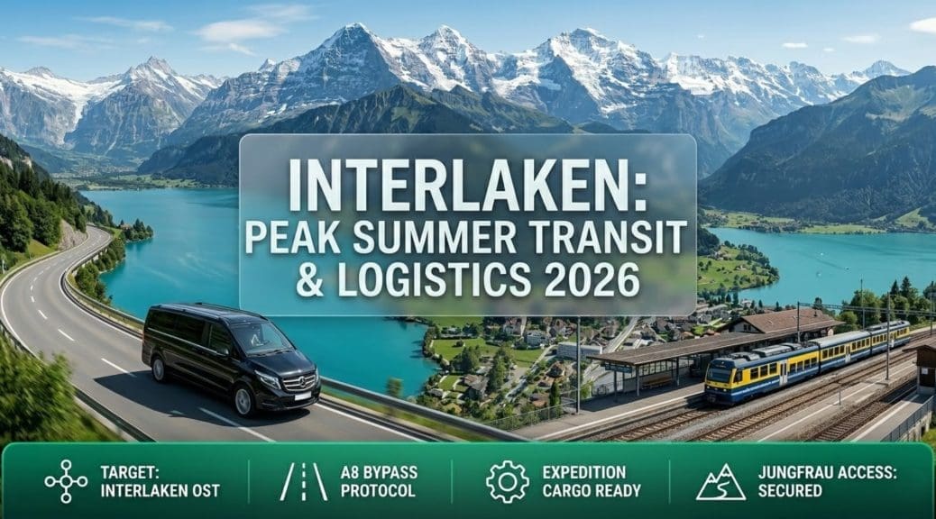
The urban geography of Interlaken is split by two distinct transport hubs: Interlaken West and Interlaken Ost. Interlaken West services the commercial core and standard municipal accommodations, while Interlaken Ost functions as the hard transition point for the mountain railway networks accessing Grindelwald and Lauterbrunnen. Ground transport logistics must target the correct specific perimeter based on the passenger’s final onward destination.
Arriving at the incorrect transit hub introduces immediate, punishing logistical friction. The distance between Ost and West measures approximately two kilometres. While theoretically connected by a central road, traversing this distance during a summer weekend in a vehicle can require upwards of 45 minutes due to pedestrian crossings, horse-drawn carriage traffic, and severe vehicular density along the Höhematte.
Professional transit operators execute precise drop-off protocols mapped directly to the correct perimeter. If the delegate is transitioning immediately to the Jungfrau region, the transport asset terminates exclusively at the Interlaken Ost staging zones. This strict adherence to geographical targeting prevents the necessity of secondary intra-resort transit, ensuring the passenger crosses the municipal boundary and intercepts their onward connection without delay.
Aviation Ingress: Zurich Airport (ZRH) Extraction Protocols
Terminal Capacity and Baggage Retrieval
Zurich Airport (ZRH) operates as the definitive intercontinental aviation node for accessing the Swiss plateau and the Bernese Oberland. The terminal environment processes maximum passenger volumes during peak summer changeovers. Extracting a group and their technical alpine hardware from this high-density zone demands pre-planned, instantaneous execution. Loitering in the arrivals hall while attempting to secure unverified transport guarantees exposure to extreme crowd density.
Summer alpine manifests consist heavily of oversized sporting cargo. Paragliding rigs, extensive mountaineering hardware, and rigid downhill mountain bike cases bypass standard luggage carousels. Ground crews manually deposit these items at designated oversized baggage counters. Passengers must deploy a bifurcated extraction strategy, assigning personnel to monitor standard belts while simultaneously clearing the oversized drop zone to prevent critical equipment from stalling the terminal exit.
Deploying a pre-booked Zurich to Interlaken transfer neutralises terminal friction. The professional driver intercepts the group directly at the arrivals gate, assuming total physical control of the hardware. The delegate is isolated within the vehicle cabin while the driver executes rapid loading sequences. This tarmac-to-vehicle transition bypasses passenger congestion and immediately initiates the highway transit phase.
Bypassing SBB Rail Network Friction
The Swiss Federal Railways (SBB) network connecting Zurich Airport to Interlaken requires mandatory transfers, typically at Zurich Hauptbahnhof (HB) and Bern. Operating this route with heavy summer luggage introduces catastrophic multi-modal failures. Passengers must manually haul 30kg expedition packs and rigid flight cases across fragmented, multi-level platforms.
The intercity trains servicing the Zurich-Bern-Interlaken corridor operate at absolute maximum passenger density during the peak summer months. Forcing high-net-worth individuals or heavily encumbered alpinists to drag hardware into crowded carriages actively destroys the premium transit experience and induces severe physiological stress before the alpine deployment begins. Furthermore, public rail schedules do not align precisely with private aviation arrivals, forcing delegates to operate on rigid, inflexible public timetables.
Securing a direct Alps2Alps transport asset overwrites this public transit deficit. The protocol mandates point-to-point delivery. The vehicle internalises all specialist cargo and luggage, isolating the passenger from the physical strain of public rail navigation. The transit terminates exclusively at the exact coordinates of the Interlaken accommodation or the Ost railway terminal, securing the timeline and preserving baseline energy.
Ground Transit Execution: The Bern vs. Lucerne Routing Dilemma
The A1 to A6 Bern Corridor
Executing the 130-kilometre ground vector from Zurich to Interlaken presents a definitive routing choice. The primary, high-speed trajectory utilises the A1 autobahn to Bern, transitioning to the A6 and finally the A8 towards Interlaken. Under optimal summer parameters, this route requires approximately 105 to 120 minutes. It prioritises sustained highway velocity and avoids severe topographical gradients.
However, this specific corridor intersects the Bern municipal perimeter. During peak morning and evening commuter windows, the A1/A6 interchange gridlocks. International tourist volumes compounding standard commercial traffic frequently trigger multi-kilometre stationary queues. Professional drivers must monitor this density using real-time GPS telemetry. When the Bern intersection fails, operators must execute immediate tactical reroutes or adjust cruising velocity to intercept the bottleneck during its dissipation phase.
The transition from the A6 to the A8 at Spiez introduces the final structural constriction. The autobahn drops to a two-lane arterial road hugging the shoreline of Lake Thun. This sector lacks overtaking lanes and strictly regulates speed limits. Motorised transit becomes locked into convoys behind heavy agricultural vehicles and commercial coaches. Drivers must maintain precise momentum management to prevent abrupt braking sequences, shielding passengers from motion sickness along the winding lakeside route.
The A4 to A8 Lucerne Trajectory
The secondary transit vector operates via Lucerne, traversing the A4, A14, and A8 corridors before initiating the Brünig Pass ascent. This route measures approximately 100 kilometres but introduces massive topographical drag. The trajectory prioritises aggressive ascents and descents over sustained highway speed. It serves as a tactical alternative only when the Bern corridor suffers catastrophic infrastructural failure due to severe traffic incidents.
The Lucerne route relies heavily on passing through the dense urban and tunnel networks of central Switzerland. The 2026 summer season features extensive scheduled roadworks and tunnel maintenance along the A8 Hergiswil-Stansstad sector. These infrastructural modifications restrict traffic to single lanes, generating severe mid-day bottlenecks. Deploying this route blindly guarantees exposure to stationary traffic deep within subterranean tunnel systems, elevating cabin temperatures and passenger anxiety.
Selecting the optimal vector requires absolute topological intelligence. Professional transport operators do not rely on standard algorithms. They analyse the aggregate traffic density across both the Bern and Lucerne corridors prior to departing Zurich Airport. The driver commits to the route demonstrating the highest probability of uninterrupted forward momentum, securing the strict itinerary timeline mandated by the passenger.
The Brünig Pass Bottleneck: Topographical Friction
Topographical Constraints and Multi-Use Traffic
If the Lucerne routing vector is engaged, the transit must navigate the Brünig Pass. Cresting at 1,008 metres, this mountain pass connects central Switzerland directly to the Bernese Oberland. The tarmac features severe gradients, narrow tunnel sections, and a succession of tight hairpin bends carved into the rock face. Attempting to navigate this gradient in an underpowered rental vehicle mathematically guarantees brake degradation and acute passenger motion sickness.
Summer operations introduce severe multi-use friction on the Brünig pass. The route is heavily populated by descending commercial freight, ascending peloton cyclists, and massive volumes of domestic tourist traffic pulling caravans. The absolute lack of overtaking lanes traps motorised vehicles in slow-moving convoys. Passing on blind corners guarantees head-on collisions with descending heavy vehicles.
Professional execution demands momentum management. Drivers familiar with the Brünig altitude profile anticipate the structural pinch points near Lungern and the final steep descent into Meiringen. Maintaining a stable, linear ascent profile shields passengers from lateral G-forces. This expert throttle application prevents the physical exhaustion associated with volatile, stop-start mountain driving.
Meteorological Variables on the Pass
Atmospheric conditions on the Brünig Pass demonstrate extreme, predictable volatility. Intense July thermal convection reliably generates severe unforecasted electrical storms and torrential rain cells. These localised weather events drastically reduce visibility and coat the asphalt in a slick layer of summer oils and water, instantly degrading tyre traction and extending mandatory braking distances.
Navigating these sudden meteorological shifts requires advanced vehicle stability systems and absolute driver competence. Independent drivers frequently panic-brake during sudden downpours, causing cascading rear-end collisions that sever the pass completely. Professional operators adjust velocity prior to intercepting the storm cells, maintaining a controlled descent profile into the Haslital valley without triggering ABS interventions.
In the event of a total pass closure due to mudslides or catastrophic accidents—a persistent risk during the 2026 summer storm season—the vehicle is physically trapped. Professional operators monitor the cantonal police frequencies. If a closure is imminent, they execute an immediate 180-degree extraction, rerouting the entire transit back through Lucerne and engaging the Bern corridor to ensure the passenger reaches Interlaken, regardless of the added geographical distance.
High-Capacity Fleet Operations and Alps2Alps Protocols
Long-Wheelbase Vehicle Deployment
Summer alpine manifests demand high-cubic-volume long-wheelbase vans. Standard municipal taxis and algorithmic ride-hailing sedans completely lack the internal dimensions to process multi-person luggage configurations alongside rigid expedition packs and climbing hardware. Forcing technical equipment into inadequate boots compromises passenger seating zones and introduces severe structural risks to high-value assets.
Securing an Alps2Alps transit asset resolves this cargo deficit. The fleet architecture internalises all hardware within a secure, climate-controlled rear bay. Complete separation of the payload from the passenger cabin ensures the team remains secure and isolated from shifting loads during the steep descents into the Bödeli plain.
External roof mounting is categorically rejected. It exposes high-value hardware to sudden alpine precipitation, road debris, and opportunistic theft during mandatory toll plaza stops or rest intervals. Internalisation maintains a sterile, secure environment from the Zurich aviation terminal directly to the Interlaken resort perimeter.
Real-Time Telemetry and Route Adaptation
Professional ground execution relies on advanced spatial mapping and real-time telemetry. Alps2Alps drivers monitor the A6, A8, and Brünig corridors for sudden traffic spikes. When the primary highway gridlocks, these operators execute immediate tactical reroutes along secondary valley service roads. This geographic agility bypasses stationary columns, preserving the strict transit timeline required for groups operating on rigid daylight schedules.
The final approach into Interlaken demands professional spatial management. Drivers anticipate the structural pinch points at the Ringgenberg tunnel or the Därligen bottleneck. Bypassing the stagnant traffic frequently requires exploiting municipal backroads through Unterseen to access the northern resort sectors without crossing the congested central Höheweg.
The ground transit terminates with a rigid point-to-point delivery protocol. The vehicle deposits the group precisely at the designated accommodation coordinates within Interlaken, executing a rapid kerbside offload. This efficiency eradicates tarmac loitering, seamlessly transitioning the passenger into the high-altitude resort fabric without secondary logistical friction.
Managing Specialist Alpine Cargo and Oversized Luggage
Aviation Limits and Hardware Internalisation
Airlines strictly cap oversized sporting equipment at 32kg. Paragliding canopies, technical climbing hardware, and rigid downhill mountain bike cases must be packed within compliant, impact-resistant flight containers. Exceeding weight limits guarantees terminal overage fees and catastrophic structural hardware damage during automated baggage sorting at Zurich Airport.
Extracting this equipment from the terminal mandates the deployment of extended passenger vans. The transfer vehicle must possess the exact internal dimensions to stack rigid flight cases vertically, entirely separating them from soft expedition packs. This prevents puncture damage caused by high-speed transit vibrations on the Swiss autobahn network.
Climate control within the cargo bay protects sensitive equipment. Transitioning from the 35°C tarmac at Zurich to the air-conditioned cabin prevents the thermal expansion of hydraulic fluids in mountain biking systems and protects sensitive electronic telemetry hardware from the severe meteorological variables present during the transit block.
Securing High-Value Expedition Gear
High-value mountaineering and sporting fleets represent primary targets for organised theft rings operating across European transit hubs. Exposing this equipment during public rail transitions or storing it in open-air municipal car parks mathematically guarantees asset loss. The ground transfer protocol must prioritise absolute hardware security from terminal extraction to hotel delivery.
Internalising the payload within the Alps2Alps vehicle neutralises the risk of opportunistic theft. The hardware is locked within the reinforced cargo bay, completely inaccessible from the exterior. Drivers maintain visual or physical proximity to the vehicle during any mandatory refuelling stops, ensuring the manifest remains sterile.
The transition at the Interlaken accommodation dictates the final security phase. The transfer driver executes a kerbside offload directly into the custody of the hotel porter staff or the expedition delegates. Luggage must be transitioned immediately into secure, alarmed indoor storage rooms. Leaving technical equipment unattended on the public pavement outside the hotel exposes the assets to immediate theft within the highly populated urban core.
Interlaken Urban Navigation and Parking Deficits
Interlaken Ost and West Traffic Gridlock
Interlaken’s central road network collapses daily during the peak July and August windows. The primary artery connecting Interlaken West and Interlaken Ost is severed continuously by pedestrian crossings, dense domestic tourist volumes, and the slow-moving horse-drawn carriages operating on the Höhematte. Traversing the town centre in a motorised vehicle between 10:00 and 18:00 is an operational error that destroys itinerary timelines.
Municipal police actively funnel uncredentialed traffic into peripheral ring roads. Drivers attempting to locate specific hotels within the central pedestrian zones face hydraulic bollards and immediate interdiction. Professional transfer operators possess the required topographical intelligence to bypass the central promenade, utilising northern access routes via the Aare river bridges to deliver passengers directly to their exact coordinates without intersecting the central gridlock.
Executing drop-offs at the Interlaken Ost railway station requires high-speed coordination. The designated unloading zones operate under continuous surveillance to prevent static vehicles from obstructing the regional PostBus fleet. Drivers must extract the luggage instantly upon halting the vehicle. Passengers must immediately assume control of their hardware and clear the drop-off zone to prevent municipal fines and logistical bottlenecking.
Municipal Parking Collapse and Micro-Mobility
Interlaken suffers from a chronic deficit of high-capacity parking infrastructure. Subterranean facilities and open-air municipal lots reach absolute capacity by 09:00 daily during the summer peak. Operating a personal rental vehicle within the municipality mandates endless circulation loops searching for vacant bays, haemorrhaging critical itinerary time and generating severe driver fatigue.
Abandoning the personal vehicle concept is a strict logistical requirement. Once delivered to the resort via a professional transfer, delegates must rely entirely on the municipal transit infrastructure. The BÖDELI bus network operates high-frequency loops connecting all primary accommodations to the Ost and West railway terminals, eliminating the requirement for private vehicular transit across the alluvial plain.
Electric micro-mobility provides the optimal vector for short-range municipal navigation. E-bikes bridge the geographical gaps between peripheral accommodations in Unterseen or Matten and the central transit hubs. However, riding through the densely packed Höhematte pedestrian zones is strictly regulated. Riders must utilise designated cycle lanes and deploy certified, heavy-duty D-locks when abandoning the asset, as high-end e-bikes are primary targets for regional theft.
Intercepting the Jungfrau Region Railway Network
Transitioning to the BOB (Berner Oberland-Bahn)
Interlaken Ost functions as the hard transition point for all deployments into the high-alpine Jungfrau region. The municipal road network physically terminates for heavy tourist traffic at Grindelwald and Lauterbrunnen. Bypassing these secondary bottlenecks requires immediate integration with the Berner Oberland-Bahn (BOB) railway network departing from the Ost terminal.
The transition from the Alps2Alps ground transfer to the BOB platforms requires seamless logistical synchronisation. The transfer vehicle terminates at the Ost drop-off zone. Passengers must manually execute the hardware transfer from the vehicle to the rail platform. Planners must pre-purchase digital SBB or Jungfrau Railway ticketing to bypass the massive physical ticket office queues, allowing immediate progression through the boarding turnstiles.
Boarding the BOB with heavy alpine hardware during the morning peak requires aggressive spatial management. The carriages operate at maximum density. Expedition packs and rigid cases must be stored in designated luggage racks immediately upon boarding to prevent obstructing the transit aisles. Securing these assets quickly guarantees the passenger a seat for the steep rack-and-pinion ascent into the Lütschine valleys.
Timetable Synchronisation and Egress
The BOB network operates on rigid, fixed intervals. Missing a targeted departure truncates the operational timeline and delays the subsequent connections required to reach the Jungfraujoch or the Eiger Glacier. Planners must engineer exact alignments between their Zurich airport ground ingress and the specific rail departure times, building in a minimum 30-minute buffer zone to absorb any residual highway traffic delays.
Synchronising the return extraction demands equal precision. Delegates descending from the Jungfrau region must intercept the BOB trains connecting back to Interlaken Ost. The ground transfer vehicle executing the return leg to Zurich Airport is scheduled to rendezvous precisely at the Ost terminal. Missing the descending train severs this connection, forcing the transport asset into a holding pattern and risking the passenger’s international flight departure.
Executing the entire Zurich-to-Jungfrau transit block requires immense physical and cognitive stamina. The transition from intercontinental flight, to high-speed autobahn transfer, to high-altitude rack railway induces severe physiological fatigue. The private Alps2Alps transfer phase must be treated as the sole recovery window within this sequence, insulating the passenger in a climate-controlled, secure environment before they engage with the punishing multi-modal realities of the Swiss alpine railway network.
Interlaken Summer Transport & Activities FAQ 2026
1. Is Interlaken open and worth visiting in the summer?
Yes. Interlaken operates as the primary high-density hub for summer alpine tourism in Switzerland. It functions as the mandatory gateway for accessing the Jungfrau region and provides comprehensive infrastructure for extreme sports, high-altitude hiking, and lake navigation.
2. How do I get from Zurich Airport to Interlaken?
Execute a pre-booked, direct private transfer. This ground vector utilises the A1, A6, and A8 autobahns, bypassing the multi-stage failures of the public rail network. Professional drivers internalise heavy luggage and deliver passengers point-to-point to their Interlaken accommodation.
3. Is there a direct train from Zurich to Interlaken?
Direct trains operate from Zurich Hauptbahnhof (HB) to Interlaken Ost. However, arriving at Zurich Airport (ZRH) usually dictates a mandatory rail transfer at Zurich HB or Bern. This multi-modal sequence forces travellers to manually haul luggage across densely packed, multi-level platforms.
4. How long is the ground transfer from Zurich to Interlaken?
A direct road transfer requires approximately 105 to 120 minutes under optimal summer parameters. This duration fluctuates based on traffic density at the Bern interchange or the specific routing required to bypass A8 autobahn bottlenecks.
5. What are the primary summer activities in Interlaken?
Interlaken is the epicentre for European paragliding, canyoning, and white-water rafting on the Lütschine river. Secondary activities include high-altitude hiking in the Jungfrau region, mountain biking, and maritime transit across Lake Thun and Lake Brienz.
6. Can you drive directly into the Jungfrau region from Interlaken?
You can drive as far as Grindelwald or the Lauterbrunnen valley floor. However, accessing Wengen, Mürren, or the Jungfraujoch is mathematically impossible by car. These are strict car-free zones requiring mandatory transitions to the BOB or Wengernalp railway networks at Interlaken Ost or Lauterbrunnen.
7. Where can you park in Interlaken during peak summer?
Municipal parking is critically deficient. Subterranean lots and public spaces reach absolute capacity by 09:00 daily. Operating a rental vehicle guarantees extreme logistical friction. Abandon the personal vehicle concept and rely entirely on professional transfers and the local BÖDELI bus network.
8. How hot is Interlaken in July and August?
The Bödeli plain experiences intense solar thermal loading. Daytime temperatures frequently exceed 30°C. This heat reliably triggers severe, unforecasted afternoon electrical storms, mandating early-morning execution for all outdoor and high-altitude deployments.
9. Do I need a car in Interlaken?
No. A car is an active liability. The municipality enforces strict pedestrian zones, and traffic gridlocks daily. Public transit networks, municipal electric mobility, and dedicated mountain railways provide comprehensive access to all primary topographical assets.
10. What is the Berner Oberland Pass?
The Berner Oberland Pass is a digital, multi-day transit credential. It grants unrestricted free access to the majority of trains, buses, and boats across the canton of Bern, including specific cable cars and the BOB railway connecting Interlaken to the Jungfrau perimeter valleys.