Transport Strategies for Accessing Vanoise National Park via Méribel
TL;DR: Transport Strategies for Accessing Vanoise National Park via Méribel
Accessing the Vanoise National Park via the Méribel valley requires overriding standard public transit failures. The geographical boundary of the park sits strictly above Méribel-Mottaret, dictating a hard stop for all unauthorised vehicular traffic at the Lac de Tuéda Nature Reserve. Breaching this perimeter relies entirely on pre-engineered logistics, transitioning from high-velocity airport transfers to the strictly regulated pedestrian corridors of the high alpine zone.
Executing this ingress dictates reliance on dedicated Alps2Alps transfers from primary aviation hubs like Geneva or Chambery. Standard rail links to Moûtiers force travellers into punishing manual luggage hauls before boarding regional buses up the steep D90 ascent. Deploying a point-to-point transfer asset neutralises this friction, delivering climbing hardware and alpine expedition gear directly to the Mottaret staging grounds, ensuring the Vanoise itinerary initiates without schedule collapse.
The Gateway to Vanoise: Méribel-Mottaret and the Lac de Tuéda Reserve
Defining the Méribel-Mottaret Access Vector
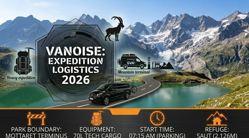
Méribel-Mottaret functions as the definitive topographical terminus for the central Les Trois Vallées road network. Located at an elevation of 1,750 metres, this satellite village acts as the primary northern gateway into the Vanoise National Park. The D90 road physically terminates here. Proceeding beyond this coordinate requires a mandatory shift from motorised transit to pedestrian execution.
The municipal infrastructure at Mottaret enforces this transition. The Plan à l’Eau parking facility represents the final authorised staging area for civilian vehicles. During the peak summer operations of 2026, this infrastructure reaches absolute capacity by 08:00 daily. Alpinists and hikers arriving later face definitive access denial and must abandon their vehicles in the lower Méribel Centre, relying on the municipal Méribus network to breach the final 300 vertical metres.
Operating within this sector demands strict adherence to the National Park’s environmental mandates. The Vanoise is a heavily protected ecological zone. Unauthorised vehicular penetration beyond the Mottaret barriers triggers immediate interdiction and severe financial penalties. Logistical planning must account for the manual transport of all expedition hardware, climbing racks, and bivouac equipment from the drop-off coordinate into the park perimeter.
The Lac de Tuéda Nature Reserve Perimeter
The Lac de Tuéda Nature Reserve serves as the ecological buffer zone between the commercial infrastructure of Méribel and the core Vanoise National Park. Spanning from the Lac de Tuéda up to the Glacier de Gébroulaz, this reserve enforces strict operational limitations. Mountain biking is restricted to designated peripheral tracks, and dogs are categorically banned, even on leads, to protect indigenous marmot and chamois populations.
Transitioning through this reserve dictates the pace of the initial approach. The terrain immediately surrounding the lake consists of flat, accessible paths constructed through Arolla pine forests. The gradient sharply increases upon exiting the Tuéda basin towards the Refuge du Saut. Hikers must calibrate their load distributions at the Mottaret drop-off zone before entering the reserve. Secondary repacking on the steep, exposed ascent trails disrupts forward momentum and exposes gear to sudden weather shifts.
The altitude profile of the Tuéda approach requires specific physiological management. The route ascends rapidly from 1,750 metres to over 2,100 metres at the refuge boundary. Travellers transitioning directly from a sea-level aviation ingress to this trailhead within a single day face acute oxygen saturation drops. Immediate, high-velocity hiking through the reserve reliably induces altitude lethargy, mandating a slow, methodical transit pace during the initial two hours of the Vanoise approach.
Aviation Ingress: Geneva and Chambery Airport Transfers
Geneva Airport (GVA) Logistics and Routing
Geneva Airport operates as the primary high-volume ingress node for the Tarentaise Valley. The geographical vector from GVA to the Vanoise boundary measures approximately 135 kilometres. The route relies entirely on the A41 motorway south to Annecy, transitioning to the N90 dual carriageway at Albertville. Under standard summer conditions, this transit requires 120 to 140 minutes, contingent entirely on the traffic density at the Swiss-French border and the Moûtiers bottleneck.
Navigating the GVA arrivals terminal with technical alpine gear introduces immediate logistical friction. Expedition packs, rigid climbing hardware cases, and heavy mountaineering boots trigger oversized baggage protocols. Groups must secure a pre-booked Geneva to Méribel transfer to extract this equipment rapidly. Relying on the regional Léman Express rail connection to Annecy forces multi-stage manual hauling, exposing sensitive hardware to transit damage and theft.
Deploying an Alps2Alps long-wheelbase vehicle internalises the equipment load. Drivers intercept the group directly at the arrivals gate, bypassing the chaotic public taxi ranks. The vehicle secures the hardware within a climate-controlled cargo bay, isolating the passengers. This point-to-point vector ensures the group reaches the Méribel-Mottaret staging ground without interacting with the heavily congested SNCF rail hub at Moûtiers, preserving baseline energy for the park ascent.
Chambery Airport (CMF) Tactical Alternatives
Chambery Airport (CMF) provides a specific tactical alternative to the Geneva hub. Located 100 kilometres from the Vanoise boundary, it serves regional and chartered flight networks. Bypassing GVA entirely, Chambery eliminates the severe delays associated with international border control and the massive passenger volumes traversing the Bardonnex crossing during peak July and August weekends.
The ground transit phase from Chambery exploits the A430 directly into the Tarentaise Valley. Executing a Chambery to Méribel transfer reduces the baseline travel time to approximately 90 minutes. This abbreviated vector relies on the N90 corridor from Albertville to Moûtiers. Professional transfer operators deploy real-time GPS telemetry to monitor the N90. When the primary artery gridlocks due to agricultural freight or tourist influx, drivers execute tactical reroutes via secondary valley roads.
Fleet architecture remains a rigid parameter for Chambery arrivals. Groups targeting the Vanoise National Park frequently carry multi-day supply loads. Standard municipal taxis operating out of CMF lack the cubic volume to secure these payloads internally without breaching passenger seating zones. Pre-booking an Alps2Alps transport asset ensures the dispatch of a high-capacity van, confirming that all expedition gear and personnel are consolidated into a single, high-efficiency transit movement to the Mottaret trailhead.
Ground Transit Execution: Alps2Alps Routing via the N90
Navigating the Moûtiers Bottleneck and the N90 Corridor
Executing the primary ground transit phase from northern aviation hubs relies entirely on the N90 dual carriageway. This critical arterial route funnels all traffic from Albertville deep into the Tarentaise Valley. During the peak summer deployment windows of July and August 2026, the N90 absorbs a massive convergence of international tourists, heavy agricultural freight, and logistical supply chains servicing the high-altitude resorts. This extreme density degrades the velocity of the route, transforming a standard 45-minute highway sector into a volatile transit variable.
The definitive failure point on this vector occurs at the Moûtiers interchange. At this exact geographic coordinate, the high-speed N90 terminates, forcing all accumulated traffic to exit onto the steep, winding departmental roads servicing the individual Les Trois Vallées resorts. Relying on standard GPS navigation during weekend changeovers drives independent vehicles directly into stationary queues at the Moûtiers roundabout. Attempting to clear this bottleneck without real-time topological intelligence guarantees severe itinerary delays and disrupts scheduled Vanoise National Park ascents.
Securing Alps2Alps transport directly mitigates this infrastructural trap. Professional drivers deploy advanced traffic telemetry to monitor the N90 density in real time. When the Moûtiers approach gridlocks, these operators execute immediate tactical reroutes, leveraging secondary valley roads and service routes unknown to consumer navigation algorithms. This geographic agility bypasses the stationary tourist columns, preserving the strict transit timeline required for alpinists operating on rigid daylight schedules.
The D90 Ascent and Tactical Fleet Deployment
Transitioning from Moûtiers to the Vanoise staging grounds dictates a punishing ascent via the D90. This 18-kilometre mountain road climbs rapidly from 600 metres to the 1,750-metre elevation of Méribel-Mottaret. The route features a succession of tight hairpin bends shared with high volumes of descending peloton cyclists and ascending municipal buses. Attempting to navigate this gradient in an underpowered rental vehicle induces severe driver fatigue and subjects passengers to violent lateral forces, physically draining expedition teams before they reach the trailhead.
Vanoise National Park transport requires dedicated fleet architecture to handle specific cargo manifests. Mountaineering groups carry dense, oversized loads: 70-litre expedition packs, rigid cases containing technical climbing hardware, and extensive bivouac supplies. Standard municipal taxis completely lack the internal cubic capacity to process these payloads alongside passenger seating. Forcing this equipment into inadequate cargo spaces results in structural damage to high-value gear and creates a hazardous cabin environment during the steep alpine ascent.
Deploying a long-wheelbase Alps2Alps vehicle resolves the cargo deficit. The transport asset internalises all technical hardware within a secure, climate-controlled rear bay. The physical separation between the passenger cabin and the expedition gear ensures the team remains secure and isolated from shifting loads during the D90 hairpins. Delivering the group directly to their accommodation in Méribel or the immediate Mottaret drop-off zone ensures the team arrives physiologically intact, ready for immediate alpine deployment.
Alternative Aviation Nodes: Lyon and Grenoble Hubs
Executing the Lyon-Saint Exupéry (LYS) Extended Vector
When Geneva Airport reaches slot capacity or suffers from severe airspace congestion, Lyon-Saint Exupéry (LYS) provides the definitive intercontinental fallback. Processing a vast matrix of premium global carriers, LYS bypasses the Swiss-French border friction at Bardonnex entirely. The terminal infrastructure efficiently handles oversized mountaineering cargo, but its geographic location—approximately 180 kilometres from the Vanoise boundary—dictates a highly structured, extended ground transit phase.
Navigating this distance requires a specific Lyon to Méribel transfer. Relying on the French SNCF rail network from Lyon Part-Dieu to Moûtiers introduces catastrophic multi-modal delays. The public rail route demands multiple train changes, forcing expedition teams to manually haul 30kg packs across fragmented platforms. This physical exertion depletes critical energy reserves necessary for the subsequent high-altitude approach into the Vanoise reserve.
The private highway transit utilises the A43 and A430 autoroutes, connecting directly to the N90 corridor. Under standard summer parameters, this 120- to 150-minute vector demands premium vehicle architecture. The long-wheelbase transfer vans function as mobile recovery units, providing ergonomic seating, acoustic dampening, and precise climate control. This environment allows alpinists to execute sleep recovery following a long-haul flight, converting dead transit time into functional physical preparation.
Grenoble Airport (GNB) Summer Viability
Grenoble Airport (GNB) functions as a highly specific, tactical ingress node. While operating with lower overall flight volumes than Lyon or Geneva, Grenoble frequently services chartered routes and targeted European connections during the summer. Bypassing the massive international passenger density of primary hubs allows expedition teams to execute rapid terminal extraction. Baggage claim and customs clearance times at GNB are drastically reduced, enabling immediate transition to the ground transit phase.
The route from Grenoble to the Tarentaise valley measures approximately 170 kilometres. Executing a Grenoble to Méribel transfer relies on the A41 corridor linking to the A430. Attempting to traverse this distance via regional bus networks or convoluted rail links through the Isère valley guarantees schedule collapse. The infrequency of public transit connections from the Grenoble terminal to Moûtiers routinely strands travellers for hours, destroying rigid itinerary timelines.
Deploying a pre-booked professional transfer asset from GNB guarantees immediate forward momentum. The driver intercepts the group exactly as they exit the terminal, internalising the expedition gear and initiating the highway vector without delay. This point-to-point execution entirely neutralises the logistical drag of the alternative hub, ensuring the team reaches the Méribel-Mottaret staging ground in direct alignment with their scheduled Vanoise National Park entry window.
Intra-Valley Mobility: The Méribus Summer Network 2026
Timetables and Core Route Architecture
The Méribus summer network functions as the primary circulatory system for the entire Méribel valley. Operated by the municipality, this free transit infrastructure connects the lower valley hamlets of Les Allues directly through Méribel Centre to the high-altitude terminus at Méribel-Mottaret. Operating a personal rental vehicle for intra-valley transit is mathematically inefficient; municipal parking at key trailheads reaches absolute capacity by 08:30 daily, forcing drivers into endless circulation loops that destroy morning deployment schedules.
The Méribus summer schedule 2026 dictates strict operational parameters. During the peak July and August window, the primary line (Ligne C) operates on a high-frequency rotation, dispatching vehicles approximately every 30 to 40 minutes. However, this frequency drops sharply during the early morning and late evening blocks. Expedition teams targeting a pre-dawn alpine start must verify the exact departure of the first morning ascent. Missing this specific bus severs the mechanical link to the Mottaret staging zone, forcing a punishing, multi-kilometre manual hike up the asphalt before the actual trail begins.
Evening extraction sequences demand rigid timetable adherence. The final Méribus descending from Mottaret to the lower valley departs before 20:00. Alpinists executing long traverses from the Vanoise interior back to the Lac de Tuéda must calculate their descent velocity accurately. Failing to intercept the final sweep forces a forced bivouac or a brutal 300-metre vertical descent on foot down the valley road in deteriorating light conditions.
Equipment Integration and High-Altitude Intercepts
Boarding the Méribus with heavy Vanoise expedition loads requires strict protocol compliance. The summer fleet operates near maximum passenger capacity during peak morning ascents. Travellers hauling 70-litre packs, external climbing ropes, and ice axes must collapse and sheath all sharp implements prior to boarding. Drivers exercise absolute authority to deny entry to individuals carrying unsecured hardware that obstructs the central transit aisles or threatens the physical safety of dense passenger loads.
Strategic deployment of the Méribus bypasses the chronic parking shortages at the Plan à l’Eau staging ground. Planners must instruct their teams to secure accommodation or park their vehicles in the lower Méribel Centre parking structures, which possess higher capacity. The team then boards the Méribus fully geared, utilising the public transit asset to breach the final vertical kilometres to Mottaret. The bus drops the group precisely at the edge of the pedestrian perimeter, allowing immediate trail access.
The bus network also facilitates linear traverse routes. Hikers can initiate a route from Mottaret, cross the high alpine ridges, and descend into an entirely different sector of the valley, such as the Altiport or Le Raffort. Utilizing the Méribus network eliminates the requirement to execute a circular route to retrieve a parked vehicle. Teams simply descend to the nearest marked bus stop, intercept the scheduled downward rotation, and return directly to their base camp, maximizing geographical exploration within the park boundaries.
Final-Mile Logistics: Parking and Pedestrian Access at Plan à l’Eau
Infrastructure Saturation at the Plan à l’Eau Terminus
The Plan à l’Eau parking facility at Méribel-Mottaret marks the absolute limit of authorised civilian vehicular transit. Positioned at 1,720 metres, this tarmac perimeter represents the final mechanical staging ground before the Vanoise National Park boundary. During the peak operational windows of July and August 2026, this infrastructure suffers complete capacity failure. The finite number of parking bays reaches absolute saturation by 08:00 daily as alpinists and day-hikers deploy for early morning ascents.
Arriving at this coordinate after the 08:00 threshold mathematically guarantees access denial. Drivers must abort their approach, execute a forced retreat down the D90, and deposit their vehicles in the subterranean parking structures of Méribel Centre or lower Mottaret. This logistical failure introduces an immediate, unplanned pedestrian haul across steep, urbanised asphalt to regain the lost elevation, actively degrading the team’s physical baseline before the actual Vanoise trail commences.
Municipal enforcement at this boundary is absolute. Park rangers and local police actively monitor the access road verges. Vehicles abandoned outside designated bays or obstructing the turning circles of the Méribus network trigger immediate, unappealable fines and rapid towing protocols. Operating a personal vehicle in this sector demands rigid early-morning execution; planners must schedule arrival at the Plan à l’Eau no later than 07:15 to secure an extraction position.
Executing the Pedestrian Transition and Route Initiation
The transition from motorised transit to pedestrian execution occurs at the Plan à l’Eau boom gate. Teams must utilise this specific tarmac zone to finalise load distribution, execute final hardware checks, and transition from approach footwear to rigid mountaineering boots. Once the boundary is crossed into the Lac de Tuéda Nature Reserve, the infrastructure vanishes. The perimeter enforces strict ecological mandates: zero off-trail deviation, absolute prohibition of dogs, and a total ban on mountain biking beyond the designated western peripheral track.
The initial topographical profile is highly deceptive. The route skirts the Lac de Tuéda and traverses the Doron de l’Allues via a flat, manicured path through dense Arolla pine forests. This sector functions strictly as a physiological warm-up zone. Pacing must be rigidly controlled. Rushing this flat basin induces premature lactic acid accumulation and spikes core temperatures immediately prior to the severe gradient shift at the entrance to the Vallon du Fruit.
Upon exiting the Tuéda basin, the trail angles sharply upward. Teams face an immediate 400-metre vertical push over uneven, rocky terrain to access the higher refuge tiers. Managing this transition requires pre-programmed hydration stops and active layer shedding before the gradient initiates. Failing to vent thermal layers before hitting the ascent guarantees excessive sweating, rapid dehydration, and subsequent hypothermic risk when exposed to the high-velocity alpine winds present above 2,000 metres.
Transporting Technical Alpine and Climbing Equipment
Aviation and Ground Cargo Protocols
Transporting technical alpine hardware—crampons, ice axes, traditional climbing racks, and 70-litre expedition packs—dictates strict adherence to aviation cargo parameters. Airlines mandate that all sharp implements be fully sheathed and packed within rigid, impact-resistant flight cases. Standard soft-sided expedition packs must be wrapped in heavy-duty transit bags to prevent loose compression straps from destroying airport conveyor systems. Gross weight limits are strictly capped at 32kg per unit; breaching this threshold forces immediate, high-cost cargo unbundling at the terminal check-in desk.
Extracting this hardware from Geneva or Chambery terminals requires pre-engineered ground logistics. Standard municipal taxis and algorithmic ride-hailing vehicles cannot process multiple 70-litre packs and rigid hardware cases alongside passenger seating. Planners must secure an Alps2Alps long-wheelbase transfer vehicle. Digital booking protocols demand explicit declaration of oversized alpine loads to ensure the dispatched asset possesses the necessary cubic volume in the rear cargo bay.
Loading mechanics during the ground transfer prioritise hardware isolation. Transfer drivers must stack rigid flight cases vertically, entirely separating them from soft expedition packs to prevent puncture damage caused by high-speed transit vibrations. Internalising the entire payload within a climate-controlled bay eliminates exposure to sudden alpine precipitation and neutralises the risk of opportunistic theft during mandatory stops along the N90 corridor.
Intra-Valley Equipment Portability and Boarding Logistics
Transitioning heavy expedition gear onto the Méribus network requires total compliance with municipal transit safety regulations. The summer bus fleet operates at maximum passenger density during peak morning deployment. Alpinists must collapse all trekking poles, fully sheath ice axes, and store crampons within puncture-proof internal compartments. Drivers possess absolute authority to deny boarding to individuals displaying unsecured hardware that threatens the physical integrity of the vehicle or surrounding passengers.
Spatial management dictates boarding efficiency. Expedition members must remove 70-litre packs from their backs before crossing the bus threshold. Packs must be carried by hand and deposited in designated luggage zones or clamped firmly between the legs in the standing aisles. Forcing a fully loaded alpine pack through a crowded bus aisle mathematically guarantees entanglement and passenger injury, triggering immediate ejection by the transit operator.
The final equipment transition occurs at the Plan à l’Eau staging ground. Teams must break down their transit configurations. Flight cases and transit bags must be secured in lockers or transferred back to base camp via non-climbing personnel. The team repacks explicitly for trail operations, shifting rapid-access layers, hydration bladders, and primary navigation hardware to the exterior of the pack. This reconfiguration must be executed flawlessly before crossing into the Vanoise perimeter.
High-Altitude Refuge Logistics and Route Timings
Refuge du Saut Access and Operational Rigidity
The Refuge du Saut (2,126 metres) functions as the primary high-altitude staging asset for Vanoise ascents initiating from Méribel. Located deep within the Vallon du Fruit, this facility provides mandatory shelter and caloric replenishment for multi-day traverses. Access requires pre-purchased digital reservations executed months in advance. The operational protocol features zero tolerance for walk-in arrivals during the July and August peak; alpinists arriving without confirmed bookings are categorically denied a bed and must execute a forced descent or an illegal bivouac.
Route timings to the Refuge du Saut are mathematically fixed. A conditioned expedition team carrying standard multi-day loads requires exactly 120 to 150 minutes to execute the hike from the Plan à l’Eau terminus. The route covers approximately 6.5 kilometres and demands a sustained 400-metre vertical gain. Teams must map their departure from Mottaret no later than 14:00 to guarantee arrival within the strict check-in window enforced by the refuge wardens.
Refuge operations run on rigid, synchronous schedules. Check-in must be completed by 17:00. Dinner service initiates precisely at 19:00. Missing this seating forfeits the high-density caloric intake necessary to sustain the following day’s high-altitude push. Silence protocols are heavily enforced from 21:00 to facilitate pre-dawn alpine starts. Teams failing to adhere to these operational timelines are actively penalised and isolated by the warden staff.
Extended Ascents and Descent Extraction Timelines
Pushing beyond the Refuge du Saut targets critical geographical markers such as the Col de Chanrouge (2,530 metres) or the approaches to the Glacier de Gébroulaz (2,900 metres). Timetable execution for these sectors is entirely dictated by solar thermal loading. Afternoon thermal convection routinely triggers severe electrical storms across the Vanoise peaks by 14:00. Ascents must be initiated pre-dawn, ensuring the team summits the target pass and initiates the descent sequence before midday.
Calculating the descent velocity is critical for extraction synchronisation. Descending from 2,500 metres back to the Mottaret valley floor imposes massive kinetic impact on the knees and quadriceps, frequently slowing the pace of heavily laden teams. Planners must calculate the descent block by multiplying the standard ascent time by 0.6 to 0.7, factoring in the deteriorating physical condition of the team and the unstable scree terrain present in the upper Vanoise sectors.
The final extraction from the park must align perfectly with the valley transit infrastructure. The descent must terminate at the Plan à l’Eau exactly in phase with the pre-booked ground transport or the final descending Méribus schedule. Missing the final 19:45 municipal bus out of Mottaret severs the mechanical link to Méribel Centre, forcing a depleted expedition team to execute a punishing, multi-kilometre manual hike down the asphalt D90 under failing light conditions.
Vanoise National Park & Méribel Summer Activities FAQ 2026
1. How do I get to Parc National de la Vanoise via Méribel?
Access Parc National de la Vanoise via Méribel by proceeding to Méribel-Mottaret. The vehicular network terminates at the Plan à l’Eau parking facility near Lac de Tuéda. From this coordinate, proceed on foot south through the Tuéda Nature Reserve to cross the official National Park boundary. Utilise the Méribus network if the Mottaret parking infrastructure reaches capacity.
2. Why was the Vanoise National Park created?
The French government established the Vanoise National Park in 1963, designating it as the country’s first national park. The explicit operational objective was the preservation of the Alpine ibex (bouquetin), which faced imminent regional extinction due to uncontrolled hunting across the Mont Blanc massif and surrounding Haute-Savoie sectors.
3. What wildlife can you see in the Vanoise National Park?
The Vanoise ecosystem supports approximately 2,000 Alpine ibex and 5,500 chamois. Ground mammals include marmots, mountain hares, and foxes. The avian predator matrix features golden eagles, bearded vultures (lammergeiers), Eurasian eagle-owls, and black grouse. Visual acquisition requires strict silence and dawn or dusk deployment.
4. Are dogs allowed in the Vanoise National Park?
Dogs are categorically prohibited within the Vanoise National Park perimeter. This absolute ban applies even to dogs secured on leads. The restriction prevents pathogen transmission to wild ungulates and eliminates predatory stress on indigenous marmot populations. Working guide dogs possess the only authorised exemption.
5. What are the best hiking trails from Méribel into the Vanoise?
Primary pedestrian vectors initiating from Méribel-Mottaret include the ascent from the Lac de Tuéda basin through the Vallon du Fruit to the Refuge du Saut. Extended, high-exertion routes push beyond this staging ground to summit the Col de Chanrouge (2,530 metres) or access the base of the Glacier de Gébroulaz.
6. Can you stay overnight in the Vanoise National Park?
Overnight stays are strictly regulated. Alpinists must utilise the official high-altitude refuge network, such as the Refuge du Saut, which mandates advance digital booking. Bivouacking is permitted only within the immediate perimeter of designated refuges during the peak summer months. Isolated wild camping is illegal and actively penalised by park rangers.
7. Can you fish in Méribel during the summer?
Fishing operations are authorised at the Lac de Tuéda. This Class 1 water body functions as a dedicated fly-fishing and no-kill zone, sustaining populations of brown and rainbow trout. Anglers must procure a specific municipal or regional fishing permit prior to deploying equipment at the reserve.
8. Is paragliding available in Méribel in the summer?
Paragliding operates continuously throughout the summer window. Certified alpine aero-clubs execute tandem flights launching from high-altitude ridges, specifically the Col de la Loze and the Saulire summit. Operations leverage morning thermal updrafts to execute descents into the Méribel valley and require strict pre-booking.
9. Are there rock climbing or via ferrata routes near Méribel?
The immediate sector features the Via Ferrata de la Dent de Burgin (Croix des Verdons). Situated at an altitude of 2,700 metres, it is categorised as one of the highest and most physically demanding routes in France. Traditional sport climbing crags and bouldering sectors are located in the surrounding valley and the adjacent Courchevel perimeters.
10. When is the best time to visit the Vanoise National Park?
The optimal operational window is strictly July through August. During this block, all alpine refuges are fully staffed, public transit networks run at maximum frequency, and critical mountain passes above 2,500 metres are reliably clear of residual winter snowpack. Pre-season access in June introduces significant hazard variables, including deep snowfields and closed infrastructure.